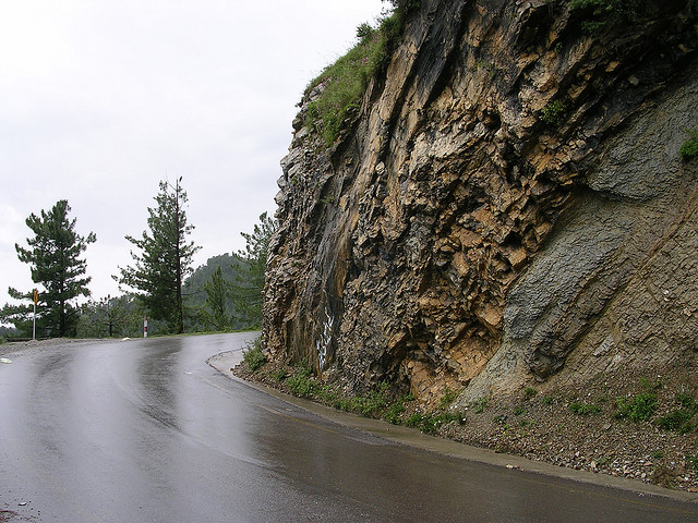
Peshawar is the capital of North West Frontier Province of Pakistan; NWFP for short. Like most ancient cities, several theories abound about its name. Babur the founding emperor of Moghul dynasty, has referred to it as 'Pushpapura', meaning the 'city of flowers'. Another theory suggests that Peshawar has been derived from Persian words 'Pish' and 'Aawar" meaning a place you encounter en route. Strategically located at the mouth of the famous Khyber Pass, Peshawar has been the Northern invasion route to India for centuries. Peshawar was founded over 2,000 years ago and became the seat of the Kushan Kings and a cradle of Gandhara Civilization. With the advent of Islam, the Persian influence brought in by the Moghuls, left a lasting impression that remains till today. Surrounded by hills and offering a mysterious charm, Peshawar has much to offer to its visitors. The population of NWFP is primarily Pathans, with a very distinctive language called 'Pushtu'. Pathans have handsome features, and they are traditionally very hospitable, but fiercely independent and a race of proud warriors, who have proved to be unconquerable. The gun totting Pathans lend a 'Frontier Town' aura, compelling some writers to call NWFP the Wild West of Pakistan. Yet this charismatic city has a unique capacity for captivating its visitors, who keep returning to be mesmerized by its charms and adventurous spirit.
Balahisar Fort :
The name Balahisar is of Persian origin and most likely given by Afghan Ruler Taimur Shah Durrani (1773 - 1793). The origin of the fort is not clear, but it is as old as the city itself, 2000 to 2500 years. The main entrance faces the old route to India. A Chinese traveler Hiuen Tsang, visited Peshawar in 630 AD, and he has described it as a royal residence of the city. According to Dr Dani, a channel of the old Bara River surrounded it once.

Historically Peshawar has always been a city of strategic importance, frequently mentioned as the seat of Ghandhara civilization. Subuktagin captured Peshawar in 988 AD, Mahmud of Ghazni in 1001 AD, Ghori in 1179 AD, and then came Babar in the 15 century and established the Mughal empire. Afghan King Sher Shah Suri destroyed the fort after the overthrow of Babar's son Humayun. Upon his return Humayun rebuilt the fort. Ahmed Shah Durrani of Afghanistan finally took it from the Mughals and made it a residential palace. His son Taimur made Peshawar his winter capital. After his death in 1793, Shah Zaman lost it to the Sikhs in 1834, who destroyed it. Then Sher Singh on orders from his father Ranjeet Singh, rebuilt the fort. An inscription from the Sikh period still survives on a gate. The British annexed Punjab in 1849 after defeating Ranjeet Singh's son, and extended their rule to Peshawar. At the time Balahisar was a mud fort, the British reinforced it with bricks and gave it the present day look. Till 1947, the fort also housed the treasury. On 14 August 1947, the Pakistan flag hoisted over Balahisar, and the following year it became the Headquarters of the Frontier Corps (FC). A small museum has also been opened inside the Fort, which has a nice display of weapons, dresses, and photographs relating to the FC. The Balahisar Fort has been opened to tourism, however prior appointment is a necessary convenience. It would be prudent to take a conducted tour, preferably through Sehrai Travel & Tours details below
Mahabat Khan Mosque :
The mosque was built in mid 17th century, during the rule of the Mughal Emperor Shah Jehan. Mahabat Khan was governor of the Peshawar region at the time, and he financed the building of the mosque, thus the eponym. It is a beautiful mosque in the traditional Mughal style. Set among the gold and silversmith shops, its narrow but massive entrance leads to a large prayer courtyard. In the middle of the courtyard is a cool blue tiled ablution pond, with a row of rooms on either side, and a main prayer hall towards the western side. The main hall is lavishly decorated inside and covered by three fluted domes. Two tall minars (towers) rise on either side of the main hall. In 1826, the Sikhs had to fight their way to Peshawar and let loose a reign of terror, which continued with the appointment of General Avitabile, an Italian mercenary, as the governor of Peshawar. Every day before breakfast, he would have a few local men hurled from the top of the minar of the Mahabat Khan Mosque to "teach a lesson to the unruly tribesmen". His cruelty has passed into the folklore of the walled city, for naughty children are often warned of the wrath of Abu Tabela, a local corruption of 'Avitabile'. The top domes of the minars were destroyed by the Sikh rulers, and later rebuilt by British. Today it is well maintained by the faithfuls. Remember to take off your shoes before entering the mosque. Ensure that you are clothed to cover your arms and legs. Also cover your head. The Mahabat Khan Mosque is located on the narrow street of Andarshar Bazaar, inside the Peshawar City. To get there, either take the Kachairy Road to Chowk Yadgar, park there and walk west 150 meters into the Bazaar; or park diagonally across the southeast end of Balahisar Fort on Hakim Ullah Jan Road, and walk up the alley of Andarshar Bazaar. The mosque is at the highest point on the street.
Bab-e-Khyber & Jamrud Fort
Bab-e-Khyber. The Khyber Gate was built in 1964, at the mouth of the Khyber Pass, where the Jamrud Fort is also located. Once way-out of the city, today Peshawar extends through the Hayatabad bazaar, that threatens to en-gulf the Bab-e-Khyber.
Jamrud Fort :
A well-known Sikh General Sardar Hari Singh Nalwa, proposed the construction of a big fort at Jamrud (originally Fattagarh) in 1836, in order to strengthen the base for further advances through the formidable defile. It is at the southern end of the Khyber Pass, where the Khyber gate stands across the road today. Construction was approved the following year and Hari Singh built a mud fort in an unbelievably short time of 54 days. However, Amir Muhammad Khan of Kabul (Afghanistan) sensed danger and attacked it in early 1837, he defeated the Sikhs and returned to Kabul. In April 1837, the local tribesmen followed suit and attacked the fort, killing Hari Singh. The fortress is situated on a mound covering a hundred square yards. It has an outer wall and an inner wall and had one entrance in each wall at the time. The route inside spirals to the top, from where one can get a commanding view of the stony barrenness that leads into the famous Khyber Pass. In 1924, the British took over the fort and constructed new barracks. Today it is part of the Peshawar garrison, and prior permission is required to visit inside.
Rawalpindi Public Park is located on Murree Road near Shamsabad. The Park was opened for public in 1991. It has a playland for children, grassy lawns, fountains and flower beds. A cricket stadium was built in 1992 just opposite the Public Park. The 1992 World Cup cricket matches were held on this cricket ground. The stadium is equipped with all modern facilities.
The objects of mild interest are:
- A Smadhi or shrine of Sardar Hari Singh Nalwa, erected in 1892 by Babuq.
- Gajhumall.
- A Gurdwara or Sikh temple.
- A well, which has a goryq tale.
- Underground cells, once used as a prison.
- The sweeping view ofq the Khyber Pass from the top.
Location
Bab-e-Khyber & Jamrud Fort are located in FATA (Federally Administrated Tribal Areas), and all foreigners have to seek permission from the Peshawar administration to go to Jamrud.
Essential Timings
Day time visits are recommended.
Peshawar Museum :
The Victorian Memorial Hall was originally the built as a center for cultural and social activities of British military and civil officers. However, when the archeological mission started excavations in various parts of NWFP, the British realized the necessity for a museum and converted this monumental building to a museum in 1906.
The red brick building of the Peshawar Museum is like a Mughal monument from the outside and a basilica from the inside. The style is typically Curzonian, amalgamated with oriental features. The interior consists of a long hall with side galleries on the ground floor and galleries on the first floor. At present there are four main galleries:
- The Gandhara Gallery houses a major collection of the museum. These artifacts come from different Buddhist sites in the Mardan District, and all the episodes on display are related to Buddhism. At the entrance of the Gallery is huge painting depicting the Gandharan Empire.
- The Muslim Gallery contains handwritten copies of the holy Quran, calligraphic specimens, manuscripts and Mughal miniature paintings.
- The Ethnological Gallery contains the dresses, weapons, household objects, musical instruments and dummies from different tribes of NWFP. The most interesting collection comes from Kafaristan in Chitral, it consists of wooden effigees of men and women.
- The Coins Gallery displays the coins of Muslim rulers of India and Indo-Greek rulers. Some specimen seals and jewels are also on display.
Shops and shopping
Peshawar offers an intensely interesting and varied shopping experience. The bazaars offer not only a wide range of merchandise but also a picturesque and entertaining arena to explore. These lively bazaars are representative of the everyday life and you can find an amazing number of people conversing in three to four languages at the same time. By far, the most interesting tour would be that of a bazaar in Peshawar. Most of these colorful bazaars are in the old city where you find a labyrinth of narrow lanes, a mosaic of traders, travelers, Pathan tribesmen and Afghans. Shops are generally open every day, except during Friday prayers between noon and 3:00pm. A detailed tour of these bazaars would take no less than a full day.
Khyber Bazaar :
The bus terminal for the Khyber Pass and Tribal Agencies is located here. Kabuli Gate, one of the walled city's 16 gates is at the end of the Khyber Bazaar. Though the gate and the walls have disappeared for the most part, some remnants are still visible. Doctors, lawyers and dentists mostly occupy Khyber Bazaar. There are a number of inexpensive hotels with reasonable room service and air-conditioning.
Qissa Khawani Bazaar (the street of the story tellers) :
Derives its name from olden times when it served as the news center for the area. It was a place where news and views were exchanged and professional raconteurs enthralled large audiences of passers-by. A walk down this bazaar is still an exciting experience. Although the storytellers are long gone the street still throbs with activity. Colorful fruit-stalls and sweetshops compete for your attention and wayside restaurants sell a bewildering variety of kebabs, grilled meats and freshly baked flat bread. The aroma of tea and cardamom fill the air mingled with sandalwood, incense and tobacco. In the mid-19th century, British Commissioner in Peshawar, Sir Edward Herbert described Qissa Khawani Bazaar as 'the Piccadilly of Central Asia'. Towering over the street are tall narrow buildings with intricately carved balconies and window frames enclosing wooden shutters. Most of the cheaper hotels can also be found here.
Brass and Copper Shops :
At the end of the Qissa Khawani Bazaar, the street takes a sharp turn left into the bazaar of the Coppersmiths. The shops here sell a range of new and old wares. Finely worked plates and samovars, teapots and vases glitter in narrow recessed stalls while the craftsmen sit cross-legged on comfortable cushions showing off their finest pieces of work. The smiths are proud and skilled men, several of them have achieved international acclaim. One of the most popular ones is Ali, who calls himself 'Poor Honest Ali'. He sells both antique and modern pieces and purchases have been reliably forwarded from here to customers all over the world. His superb work has been presented to several heads of states including Queen Elizabeth II of Great Britain.
Peshawar Pottery :
It is down a side street, immediately after the brass shops. Here you can watch the potters at work from 10:00am to 4:00pm everyday except Fridays. The wide range of ornamental and utilitarian pottery is glazed in earth colors. The potters make china and earthenware goods to order and the forwarding services are quite reliable.
Chowk Yadgar (the place of remembrance) :
From the bazaar of the coppersmiths, it is only a few minutes walk to the central square of Old Peshawar, Chowk Yadgar. The monument in the middle of the square is a memorial to those martyrs who sacrificed their lives in Pakistan's wars with India. To the left side of the square, money changers sit on hand knotted carpets with their safes behind them and their pocket calculators at hand. They will exchange any currency but accept only large notes. This chowk (square) is also the traditional site for political rallies and public meetings of all kinds.
Bazaar of Goldsmiths and Silversmiths :
Running off Chowk Yadgar to the west is Andarshah Bazaar, a narrow street of gold and silversmiths. The street is lined with tall old buildings on both sides that cast the whole area in perpetual dusk. The shops sell tribal as well as modern jewelry, antique silver, old coins and an assortment of historic military memorabilia such as buttons, buckles, regimental badges, powder cases and bayonets. The goods are displayed in showrooms, dazzlingly bright inside with mirrors and powerful lights. Jewelry can be made to order and quality is unreservedly guaranteed. The quality of precious stones or gold however may prove to be disappointing and is not reliably guaranteed. Antique and second hand silver items and semi-precious stones are much more interesting and also less risky buys for the casual shopper. While you rummage through the boxes of treasure, the shopkeeper offers you sweet green tea brewed in huge copper samovars.
Blankets and Shawls :
Beyond the Copper Market are a number of shops selling blankets and shawls from the Valleys of Swat and Kaghan. Made of hand-spun wool, these are predominantly in red or black colors with brightly patterned borders. A lane to the right leads to the Cloth Bazaar where all kinds of cloth and dress materials are available. Beyond the cloth bazaar is Basket Market, which is full of baskets from Dera Ismail Khan, a city at the southern tip of the province of NWFP. There is also a Banjara Bazaar, literally meaning ' a gipsy bazaar', that sells all kinds of oddments: carved beads of bone and wood, real and false hair, skin and hair colorants, traditional cosmetics like kajaal (black kohl). You may find some unusual decorative items here such as unique bells and hair braids. The rooms above these shops are occupied by fortunetellers and so called magicians who administer protective tattoos against supernatural attacks. The Pipal Mandi or the main wholesale grain market is also close by. There is a pipal tree in the quiet square believed to be the tree under which the Buddha preached. The Bird Market is on the main street towards Chowk Yadgar. Songbirds are sold as pets in small cages as in China. Partridges, quails and doves are also available for purchase here. The Fruit Bazaar swings around the corner into Chowk Yadgar, and offers a vast variety of dried fruits and nuts. Leather and Skin Market has shops that sell caps and hats, which are cut and stitched from curly coated Karakul lambskins and the cured skins can be purchased directly from the tanners. Many shops have tailors on hand to make Astrakhan Hats by order. Meena Bazaar is women's shopping area selling an astonishing profusion of haberdashery: ribbon and lace, buttons and bows, beads and braiding, hair ornaments and machine-embroidery. Meena Bazaar is close to the Clock Tower and also near by is the Shoe Market. Between the old city and the Cantonment area lies the Saddar Bazaar, which is full of hotels, restaurant and shops stocked with antiques and carpets. Wooden furniture inlaid with brass, Pakistani, Persian and Afghan rugs and waxed cloth are the things to look for along the main street. The waxed cloth is a traditional specialty of Peshawar. Stylized designs of birds, chrysanthemums, goldfish and dragons in Chinese fashion are worked in brightly colored wax on silk or satin cloth lengths. Little is known about its origin and the technique is a closely guarded trade secret. Bara Market, at the far end of Saddar sells foreign imports such as Italian shoes, Japanese electrical goods and Danish china. Some contraband items also find their way in this market. The back streets sell everything from guns to water heaters and lawn mowers. There is a modern shopping arcade called Shinwari Plaza that was opened in mid-1980s, half way along the main bazaar. It has been named after one of the Pathan tribes of the Khyber Agency. This is the place to look for antique silver jewelry from Afghanistan set with ivory, amber, lapis lazuli, cornelian, turquoise or malachite. The silver bangles and lockets from Turkestan are especially fine. The shops in the upper stories of the plaza also sell Afghan rugs, dresses and embroidery.
Food and drinks
Peshawar has many regional specialties, which are peculiar in taste and aroma. The most famous are Peshawari Chappli Kebabs, which are a staple diet, made from beef, herbs and corn flour. These taste best when served hot straight from the large frying pans. Saffron rice is another aromatic dish that is consumed for any meal including breakfast. A variety of grilled meats and freshly baked flat bread called 'Nan' is readily available. The favorite beverage of NWFP is the green tea that is served with style and ceremony. It is a sweet smelling and delicious drink of delicate green color and carries a faint aroma of cardamom. Pakistani food is available in all restaurants, big or small. Chicken, mutton, beef, lentils, vegetables and a variety of freshly baked breads are on the menu. Most big hotels also serve international cuisine besides the Pakistani and regional dishes. There are a few Chinese Restaurants but the dishes have a local taste instead of true Chinese flavor. Roadside food stalls serve freshly prepared hot food but care must be taken for hygienic reasons. There is plenty of fresh and dry fruits available almost everywhere in Peshawar. Drinking water is not safe unless it is bottled and sealed. Many other soft drinks are available but only the known brand names should be considered for consumption. Most hot beverages are boiled and pose no potential health concerns.
Getting around
Peshawar is well connected by air, rail and road with the rest of the country. Air links connect Peshawar to a dozen Pakistani towns and cities. It is also linked by air with Europe via Dubai. On the national rail system, Peshawar is the last stop for travelers. Bus and minibus services run between Peshawar and Islamabad (3 to 4 hours), the valleys of Swat, Dir and Chitral to the north. The desert towns to the south beyond Kohat are also accessible by road from Peshawar.
For transport within the city, taxis, auto-richshaws and tongas (horse-driven carriages) are available at varied prices. The charges are not fixed and may vary according to the condition of the vehicle or the distance and time. To/From the Airport There are many taxis available at the airport, which would cost about Rs50 to Rs100 for a trip, doubling during the night. A majority of them have meters running in them.
TAXI
Taxis are readily available in Peshawar at the airport and city itself. For touring the Northern Areas Jeep taxis can also be hired. These jeeps are not very comfortable or cheap, but the drivers are experts and the timings are flexible as they do not follow a set timetable.
BUS
Buses are the cheapest but uncomfortable except a few, to travel. They go everywhere and bus stations are mostly near railway stations.
TRAIN
Trains run frequently between Peshawar and other cities but they are slow and unpunctual. Train classes are Express and Ordinary; compartment classes are air-conditioned. First class and air-conditioned have sleeper compartments and there are special ladies' compartments recommended for women travelling alone. Air-conditioned class is almost as expensive as flying and you need to book several days in advance, especially for sleepers. Buying a ticket can be time consuming and frustrating so ask an agency or a hotel employee to handle it for you. Foreign tourists can get a 25 percent discount (50 percent for students) on most rail fares. You can apply for a discount to the Divisional Superintendent with your passport and student card at Peshawar, Karachi, Lahore, Rawalpindi, Quetta, Sukkar or Multan railway sattion for the necessary concession before you buy your ticket. You may also need a tourist certificate from the local tourist office to claim your rail discount.
 pktrack.blogspot.com
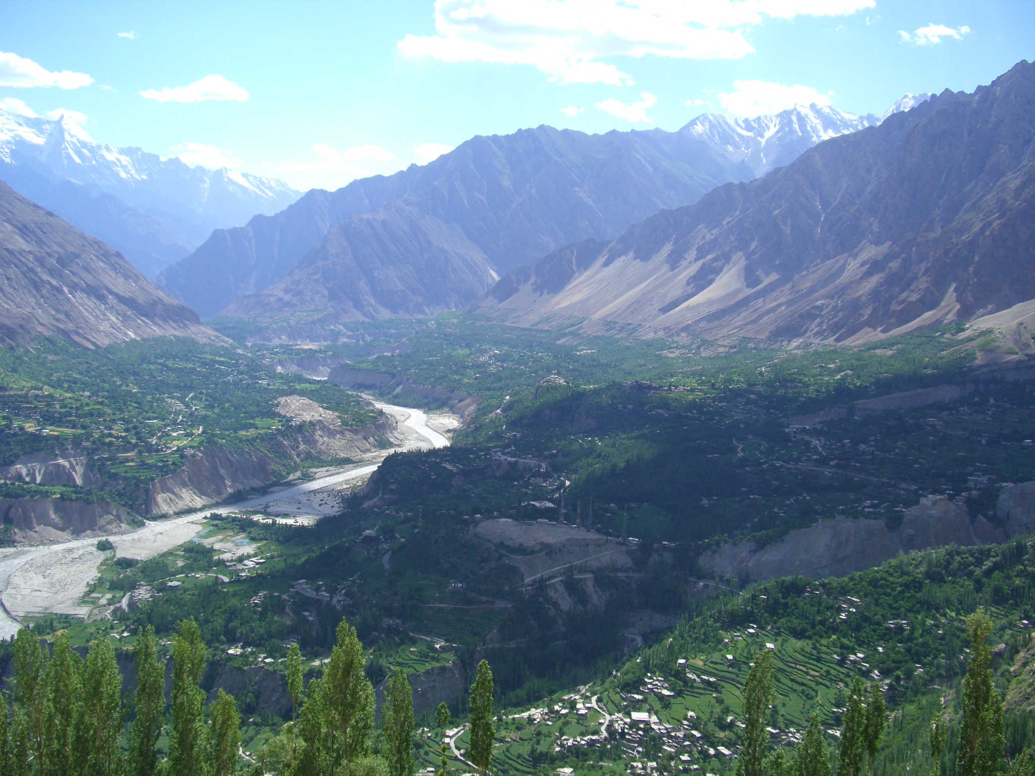
 The Lush-green valley of Swat, with its rushing torrents, icy-cold lakes, fruit-laden orchards and flower-decked slopes is ideal for holiday-makers intent on relaxation. It has a rich historical past, too.
 At an elevation of 1,454 metres lies the Gilgit Valley. The quaint little town of Gilgit has spectacular scenic beauty. The peak tourist season is from May to mid-October though the tourist season is round the year. The maximum temperature in May is 33 C and minimum 16 C. In September, Maximum 28 C and minimum 11C.
 The Chitral Valley at an elevation of 1,128 metres, is favourite with mountaineers, anglers, hunters, hikers, naturalists and anthropologists. The 7,705 metres Trichmir, the highest peak of the Hindukush range, dominates this 322 kms long exotic valley.
 Over 3,000-strong Kafir-Kalash live in the valley of Birir, Bumburet and Rambur, south of Chitral. Bumburet, the largest and the most picturesque valley of the Kafir-Kalash , is 40 kms. from Chitral and is connected by a jeep-able road. Birir, 34 kms. away is accessible by a jeep-able road. Rambur is 32 kms from Chitral.
  The Valley extends for 155 kms rising from an elevation of 2,134 metres to its highest point, the Babusar Pass, at 4,173 metres. Kaghan is at its best in the summer months (May to September). In May the temperature is: maximum 11 C and the minimum 3 C. From the middle of July up to the end of September, the road beyond Naran, snow-bound throughout the winter, is open right up to Babusar Pass.
 At Naran, 23 kms from Kaghan you reach the half-way point. Naran also serves as the base for the whole valley. From here you can ride a jeep or horse or hike in excursions to several picturesque lakes, valleys and peaks.
 Capital of Baltistan is perched 2,438 metres above sea level in the backdrop of the great peaks of the Karakoram mountain range. Baltistan is known as the "Tibet-e-Khurd" or Little Tibet since its life-style reflects that of the roof of the World and Land of Lamas.It borders on the Chinese province of Xinjiang and Indian-occupied Kashmir.
 The Deosai Plains are 32 km south of Skardu. This plateau is the habitat of the greatly threatened Himalayan Brown Bear and many other wild animals. At an average elevation of 3500 metres, Deosai is now a National Park and protected area for wildlife.
 pktrack.blogspot.com


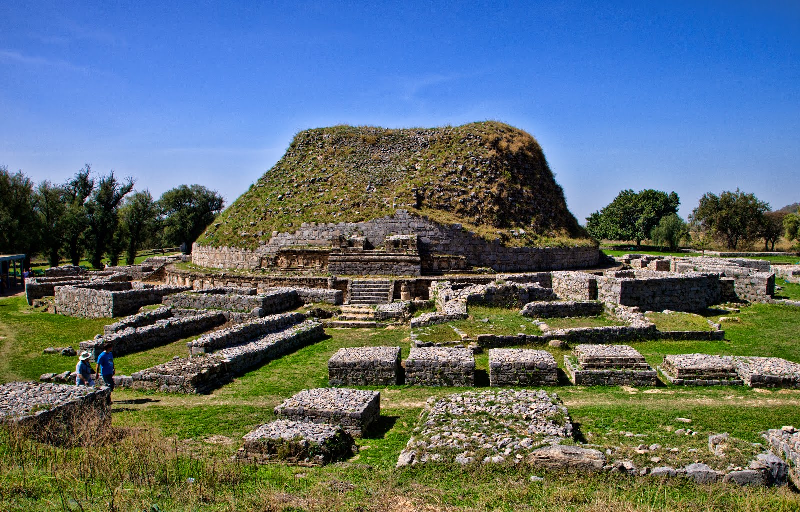 There are a number of world heritage sites present in Pakistan and Taxila is one of them. It is a city situated 31 km to the west of Islamabad and to the 36.40 km to the northwest of Rawalpindi off the Grand Trunk Road. Its other close neighboring cities include Hassanabdal, khanpur and Wah. Wah Cantt and Taxila are twin cities. It is a city with a population of 151000 people according to the 1998 census.